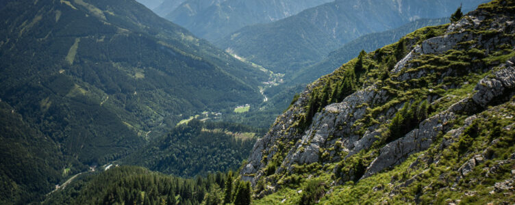
While I usually share my delightful days outdoors, not every adventure unfolds as expected. This is the story of a bike and hike in the local mountains, specifically a summit in the Vorkarwendel, Austria.
Last year, I met a fellow adventurer who recommended this particular summit, describing it as a destination with stunning views but not the most enjoyable approach. However, an encouraging detail caught my eye: it was possible to bike part of the way, allowing me to tackle ~700m of the 970m elevation by mountain bike. My only concern was that biking on forest roads in Austria is generally prohibited unless expressly permitted, but the online report indicated it was allowed.
Humid Conditions
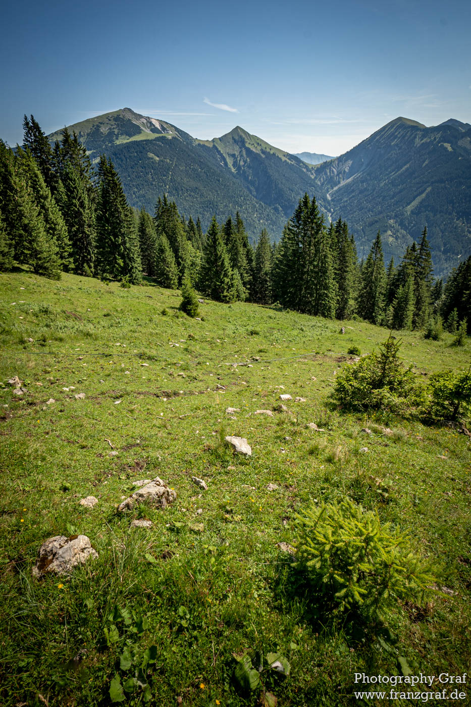
That day, I decided to make the attempt. An elevation gain of 970 meters awaited me, but the day before had been rainy, resulting in high humidity. Here I made my first mistake: considering the humidity, I should have taken more liquids with me. Unfortunately, I only packed my bike bottle, which held less than a liter of water. As I started cycling, things went well initially. The incline was manageable, the road conditions easy, and I found myself sweating but enjoying the nice views.
Discarding Plan A
However, my progress was halted as I encountered a junction that diverged from the official cycling route. A sign indicated that cycling was prohibited. It appeared that the description I relied on was either outdated or completely incorrect. Faced with a decision to ignore the sign and risk a conflict, or shorten my cycling portion, I opted for the latter. Although I doubted I would be caught, I didn’t want to explain why I chose to disregard the rules. Instead, I cautiously cycled back a bit and locked my bike to hide it.
Plan B … There’s a Trail!
With a reluctance to walk on the forest road, I revisited the map. It showed a trail above me that would lead to the same destination. Sounds like plan B! Yet, after climbing the hillside, I soon found myself in an area densely overgrown with approximately three-meter-high spruce trees. Without a path and no chance of finding one, I realized the map was outdated, likely reflecting a time when these trees were smaller or absent. Frustrated, I descended back to my bike.
Plan C … Back to the Forest Road
Doubts began to creep in about whether the day was worth continuing. I considered simply cycling a loop or returning home. Instead, I resolved to walk the forest road I initially wanted to cycle, which was now technically prohibited for cycling. The distance was about three kilometers – neither exciting nor particularly challenging, but it felt acceptable. I figured I might encounter nice views along the way. So why not just give it a try.
Half a kilometer later, I faced yet another barrier: a mudslide had eroded the road over a 50-100 meter stretch, with mud and large trees blocking the path completely. Climbing a bit into the barrier allowed me to assess the situation: the road was entirely washed away down to the mountain’s solid rock with water still flowing down. I only spent little time thinking about crossing this section. I didn’t find it wise to attempt a crossing amidst fallen trees and possibly unstable ground, especially without cell service. I’d be completely out of help in case of any accident.
Plan D …
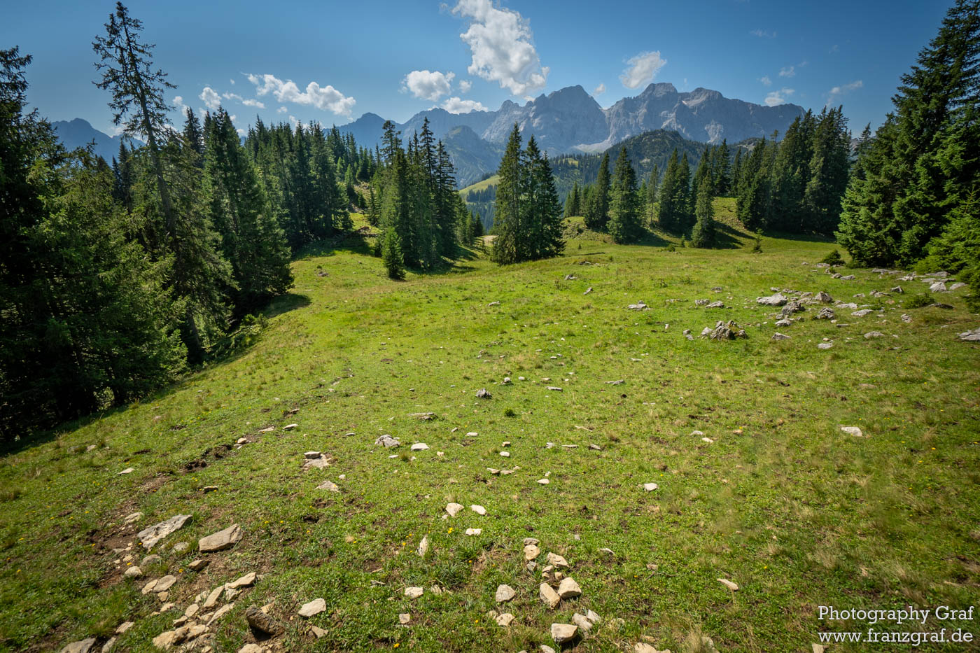
I returned to my bike again, weighing my options. I studied the map once more and decided to follow another forest road that intersected the trail further along. I traveled back to the junction, where I saw no clear sign indicating it was forbidden. Feeling confident, I continued until I reached the trail crossing the road, finally!
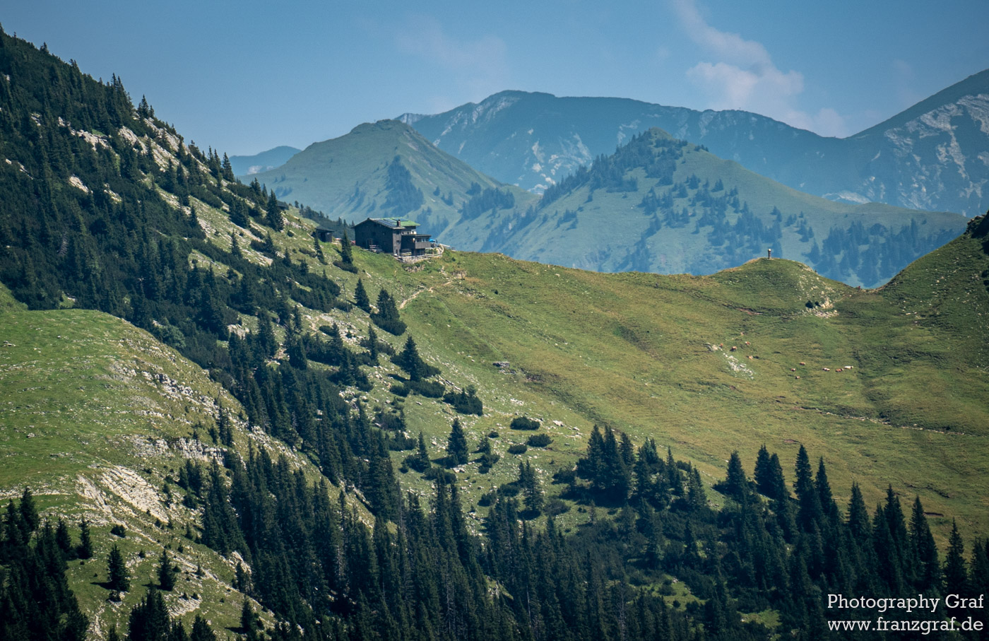
I locked my bike once more. In hindsight I should have taken a break to recuperate before proceeding. Nonetheless, I pressed on, with 500 meters of elevation still to conquer. The path was poorly marked but mostly visible. Upon reaching a small hut, I recalled that the trail I sought should end behind it. However, no signs indicated its presence. Clearly, this trail was abandoned, and I noted mentally that I would remove it from OpenStreetMap to prevent others from being misled.
Eventually, I arrived at the steep alpine meadow noted on the map. It was supposed to cover 200 meters of elevation, but I hadn’t anticipated it would be wet and muddy. Following the path upward, I soon lost the trail near a rock marked with a washed-out red symbol. Finding myself in the forest with no visible path, I opted not to waste time searching but head on. Determined, I moved in the direction in which I was sure to cross the trail again. Eventually, I found the trail again near the spot where I had initially planned to leave my bike.
By the way: Days later, a colleague told me that he also lost the path at exactly this area as well. Also some hikers that I met later confirmed going simply cross-country near that spot.
Onward to the Summit!
Despite about only 250 meters of elevation left, I felt exhausted and tired. I had already conserved my drink to ensure I had one to two sips left for the return journey. Not exactly the best preparation for a mountain hike. As I tackled the final stretch, the trail became steep but clear. Just keep going slowly and steadily. I believed that nothing could go wrong now.
That is, until I encountered cows directly on the trail. Reluctantly, I had to navigate around them on a steep incline. Thankfully, they proved to be peaceful, with only one showing excessive curiosity and following me for a short distance.
Upon nearing the top, I met a couple descending who confirmed my earlier read on the trail conditions. They warned that the lower part had been obstructed by lumbering and was not very pleasant. This allied with my relief that I had decided to cover the first stretch by bike.
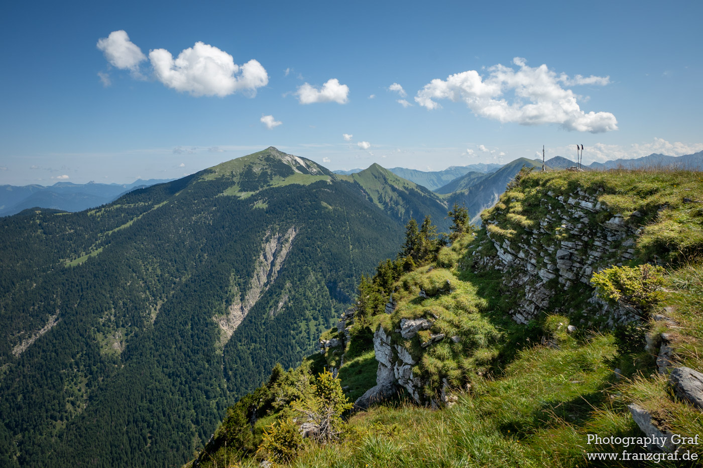
Finally at the Summit
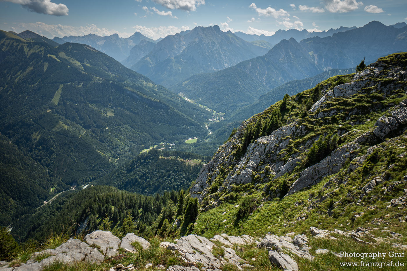
Every step up felt increasingly laborious, but I persisted knowing I was nearing the summit. Once at the top, I finally stopped to rest, enjoy a snack, and have a drink. I aimed to recover and take in the atmosphere. The views were indeed impressive, yet my physical state diminished my ability to appreciate them fully. Realizing that I wasn’t in the right mindset to take good photos, I walked around, attempting to commit the scenery to memory.

Heading Down
When I began my way back down, I engaged in conversation with a woman hiking up. I think it was good for my mood to see a friendly person. Luckily, the cows had finally moved aside, clearing my path. Things finally went well. While I didn’t lose the trail on the way down, I did glance back at the marked rock, puzzled why the trail had been elusive. From below, it was apparent that it had been nearly invisible. No surprise that I lost my way here!
The subsequent descent lacked excitement, but I felt immense relief as I hopped on my bike to roll down. Upon crossing a river, I took the opportunity to stop and cool my head. Despite my thirst, I resisted the urge to drink from the cold water, opting instead for my limited supply.
Reflecting on the Journey
I had finally reached the summit and enjoyed nice views – well as far as possible. Yet the trail experience left much to be desired. The multiple attempts combined with inadequate hydration didn’t contribute to a fun day overall. In reflection, the effort for the summit felt quite high. That afternoon, I had consumed approximately four liters of juice and water due to my significant dehydration. Should I find myself back here, I know I will be better prepared.
@blog niceI understand that "serious" mountineers have a saying:when you get to the topIf you aren't thirsty, you brought to much waterIf you aren't hungry, you brought to much foodIf you aren't tired, you didn't climb high enough:)
Uff well – I wouldn’t call that “serious”.
Actually I would there are 4 things that destroy the mountain experience: Hunger, thirst, cold, wetness. If one of these happens, the fun is quickly over. To me there’s nothing heroic in dehydration – it’s just dangerous.